

One of the most common barriers to joining a small group is simply not knowing where one meets near you. People want to know: Is there a group in my suburb? How far would I have to drive? A map answers that question instantly — better than any list of addresses ever could.
The good news is that if your church uses Planning Center Groups, you already have everything you need. PCO Embed can take your group location data straight from Planning Center and display it as a live, interactive Google Map on your website — automatically, with no manual setup required.
Why a map works better than just a list
Most church websites display their small groups as a text list: group name, day and time, general location, a contact link. It’s functional, but it makes it hard for someone to quickly answer the question that actually drives their decision — is there anything near me?
A map flips that dynamic. Instead of reading through a list hoping to spot a suburb they recognise, a visitor can immediately see clusters of groups in their area, zoom into their neighbourhood, and click through to the groups closest to them. It’s the difference between scanning a phone book and looking at a street directory.
For churches with groups spread across a wide geographic area — multiple suburbs, a whole city, or even regional campuses — a map is especially powerful. It makes a large, distributed groups ministry feel accessible rather than overwhelming.
How it works
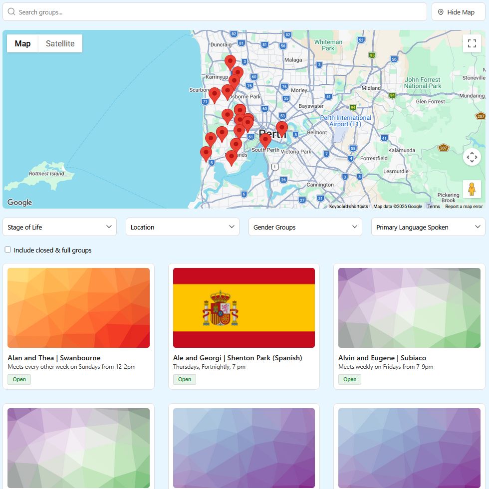
PCO Embed pulls your group data directly from Planning Center Groups, including the location you’ve entered for each group. It then plots every group as a pin on an interactive Google Map and embeds that map live on your website.
Because it connects directly to Planning Center, the map stays current automatically. When you add a new group, it appears on the map. When a group wraps up and is removed from PCO, it disappears from the map. No one on your staff needs to touch the website.
Visitors can:
- See all groups at a glance across your church’s geographic area
- Zoom in to their neighbourhood to find nearby options
- Click a pin to see the group’s details — name, meeting day and time, and an estimated location (for privacy purposes)
- Filter by group type if your church categorises groups (life groups, connect groups, youth, young adults, etc.)
What you need in Planning Center first
For the map to work well, your groups need to have a location entered in Planning Center Groups. PCO Embed pulls that location data automatically — but if a group has no address entered in PCO, it won’t appear as a pin on the map.
This is a good opportunity to do a quick audit of your groups in Planning Center and make sure each active group has a meeting location entered. It doesn’t need to be a full street address if privacy is a concern — a suburb or general area works fine for plotting an approximate pin, and many churches prefer not to publish exact home addresses publicly.
Setting it up on your website
Like all PCO Embed widgets, the groups map installs with a single line of code:
html
<script src="https://pcoembed.com/go/js/embed.js" data-type="group" data-id="YOUR-UNIQUE-ID"></script>Your unique data-it is generated in your PCO Embed dashboard when you create a groups embed. The map view is included automatically — no additional configuration needed.
For platform-specific instructions on where to paste this code in WordPress, Wix, Squarespace, or other website builders, see our guide: How to Add a PCO Embed to Your Church Website.
Where to put the map on your website
The obvious home is your Groups or Small Groups page, and that’s usually the right call. But think about placement within that page too — a map works best near the top, before the list of groups, so it’s the first thing visitors interact with rather than something they scroll past.
A few other placements worth considering:
- Your “Get Connected” or “Get Involved” page — if your church funnels new visitors toward connection, a map of groups is a compelling visual on that page
- Your homepage — a small map widget showing group locations across your city is a strong visual signal that your church is active and geographically present in the community
- A dedicated groups finder page — some churches create a standalone page specifically for finding a group, separate from general information about groups ministry, and a map is the centrepiece of that kind of page
A real example
Subi Church in Perth, Western Australia runs groups across a wide spread of Perth suburbs. Rather than asking people to read through a list of suburb names hoping to find one they recognise, their groups map lets visitors immediately see where groups are meeting across the city. Someone in the northern suburbs can zoom in and see exactly which groups are nearby — and click straight through to find out more and connect.
For a city like Perth, where distances between suburbs are significant, this kind of visual tool genuinely lowers the barrier to joining. The same principle applies to any church with groups spread across more than a handful of streets.
Page: subichurch.com/small-groups/
The broader picture
The groups map is part of what makes PCO Embed more than just a calendar tool. When your website shows a live map of group locations, a current events calendar, and an up-to-date sermon archive — all pulling automatically from Planning Center — your site stops being a static brochure and starts being a live window into your church’s actual activity.
That’s the shift worth aiming for. Not a website that gets updated when someone remembers to update it, but one that reflects what’s actually happening in your church community right now.
Ready to add a groups map to your website? Start your free 30-day trial at pcoembed.com — no credit card required.